NAVIGATION
ORIENTATION in our simulated world
The flightsim community is large and very active! Below you will find some great tools. For the purpose of this introduction I only list free add-ons and tools. The list is not comprehensive by any means :-)
Online tools
- SkyVector
SkyVector is a great online flight planning map
and is used for real flight planning as well as by many flightsimmers!
use the [World VFR] tab initially - Online flightsim sites:
-
Gemini FreeAirMap is a free moving map for practically all flightsims. You need to be online because it downloads its content on the fly (pun intended). You have to download and install it first. The P3D v4 version... It can be found here:
geminisoftware.de {You may get a warning, since it is not a SSH / https: site}
Gemini can be incorporated into your P3D cockpit nicely, if you want -
krepelka.com (website about FSX flying)
krepelka.com source of information on navigation
Offline tools
- Little Navmap can be downloaded and installed for differents sims. For P3D you need to run Simconnect as well. Once installed it looks (waits) for your sim to start running, and voilá.
Little Navmap github here
.. and is a great tool that helps plan and follow (moving map) our flight. Even in multiplayer we'll be able to see the other co-player and AI aircraft.
Other Add-ons
For additional add-on aircraft or tools look under Installations Tips
NAVIGATION in AVIATION
The following section might be a little too elaborate. You must forgive me, since besides the subject of Navigation being a hobby of mine, I have also taught the subject occasionally.
RADIO Navigation
Since terrain features are not very well represented in the sim we initially will use Radio Navigation to help us orient and find our way in the virtual world.
Before the emergence of Satellite Navigation (GNSS / GPS) aviators relied on their No.1 Eyeball for landmarks or AM broadcasting stations that sent out Morse code identification, so you could be sure you were flying to the proper station.
Knowing the basics of Radio Navigation will also help if we encounter IFR (Instrument Flight Rules) weather conditions or "IMC" (Instrument Meteorological Conditions).
Note: Flying IFR also requires that we are proficient flying the aircraft solely on instruments.
For the 2nd flight I will use an annotated Skyvector VFR (Sectional) map to show where we'll go and which help we can get from the airborne and ground based equipment.
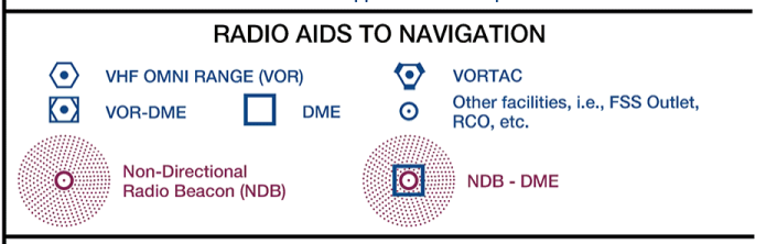
NDB and ADF
The oldest (pre WW2) NAV radio beacons are the Non Directional Beacons (NDB). They consist of AM frequency radio stations. If you tune the station in your ADF (Automatic Direction Finder) radio - and you are within reach - the ADF needle should start to move. Find the ADF in your radio stack.
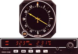
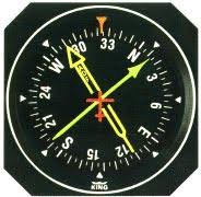
In most older aircraft, not in the Mooney we fly now (!), you'll find the ADF indicator, The arrow points to the tuned AM station. This could also be an AM music radio station, actually! To be sure the arrow is pointing correctly, we keep the broadcast Morse code signal audible in our headset.. For the purpose of this flight we'll disregard the NDB stations.
VOR
VOR stands for VHF Omni-Directional Range (or radio). In essence it sends out radio signals that represent radials. They can be compared to spokes on an old bicycle wheel. When tuned to a VOR station, you can follow one of those radials TO or FR (from) that radio station.
To stay on a specific spoke, pilots use a CDI (course deviation indicator). In the left example below (a Horizontal Situation Indicator [HSI]) the needle shows that the aircraft is flying to the station (hence the TO), with the 205° radial tuned in. The CDI shows that sthe radial lies to the left of the aircraft. Once the aircraft gets on the spoke or radial, the needle will be centered. Since the TO flag is visible it is unlikely that the red NAV flag would be visible. The right picture is an example of a possible glass cockpit representation.
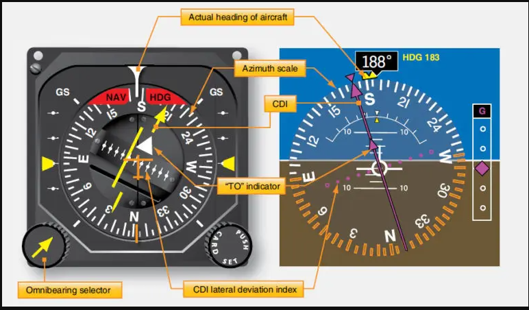
In addition to flying to and from the VOR station on a particular radial, some stations have DME (Distance Measuring Equipment). Such a station is called VOR-DME. DME shows you how many Nautical Miles you are away from the station. [TACAN] and [VORTAC] stations are VOR and DME combined and used by the military. They broadcast in the UHF band. But the [VORTAC] is also for civilian use.
LOC and ILS
An instrument landing system (ILS) operates as a ground-based instrument approach system that provides precision lateral and vertical guidance to an aircraft approaching and landing on a runway, using a combination of radio signals and, in many cases, high-intensity lighting arrays to enable a safe landing during instrument meteorological conditions (IMC), such as low ceilings or reduced visibility due to fog, rain, or blowing snow.
The localizer (LOC) part provides the precise (10x better than VOR) lateral guidance and is sometimes used without the glidepath signal. The Glideslope transmitter provides a galidepath guidance of appx. 3°.
A picture instead of a 1000 words..

RNAV
 |
 |
|---|---|
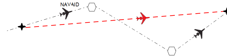
A simple diagram showing the main difference between traditional navigation and RNAV methods
Area navigation (RNAV, usually pronounced as "ar-nav") is a method of IFR navigation that allows an aircraft to choose any course within a network of navigation beacons, flying from waypoint to waypoint (WPT rather than navigate directly to and from the beacons. This can conserve flight distance, reduce congestion, and allow flights into airports without beacons. Area navigation used to be called "random navigation", hence the acronym RNAV.
Other means of navigation
PILOTAGE, CHARTS and such..
Even in your flightsimulator you can make good use of the classic techniques such as Pilotage, Reading Charts, Dead Reckoning, and Navigating with a Compass. And it is very rewarding as well!
There is a lot to say about these basic navigational skills. But in order to stay within the scope of this guide you are referred to krepelka.coms excellent online FSX training guide.
oldfashioned navigation
INERTIAL NAVIGATION or INS
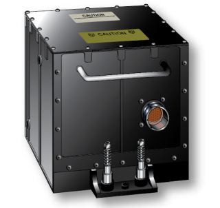
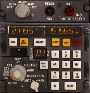
INS or Inertial Navigation Systems are in use since the beginning of WW2 and installed in military and civilian aircaft. They are installed as stand alone equipment and / or as part of a sophisticated IRS platform that integrates Radio, Inertial and GPS positions to a very accurate position (usually in LAT/LON). Explanation and use for our flights is beyond the scope of this guide.
GPS
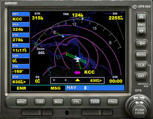
We are all familiar with GPS navigation nowadays. The 'standard' P3D GPS is modelled after the GARMIN(R) GPS 500. It needs getting 'used-to'. For our first few flights we'll not bother with is. But if you want to use it on later flights I recommend you read krepelka.coms excellent explanations. See for the GPS below:
Detailed description of the Garmin GPS 500
Some arcane means of navigation
Celestial / Astronomical Navigation
Celestial navigation, also known as astronavigation, is the ancient and modern practice of position fixing that enables a navigator to transition through a space without having to rely on estimated calculations, or dead reckoning, to know their position. Celestial navigation uses "sights", or angular measurements taken between a celestial body (e.g. the Sun, the Moon, a planet, or a star) and the visible horizon. The Sun is most commonly used, but navigators can also use the Moon, a planet, Polaris, or one of 57 other navigational stars whose coordinates are tabulated in the nautical almanac and air almanacs.
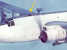
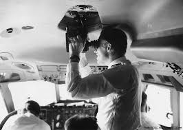
The yellow arrow shows the Astrodome on a Warwick aircraft. Next to that the Navigator on an BOAC VC-10 passenger jet.
Radar Navigation
Marine and aviation radar systems can provide very useful navigation information in a variety of situations. When a vessel is within radar range of land or special radar aids to navigation, the navigator can take distances and angular bearings to charted objects and use these to establish arcs of position and lines of position on a chart.
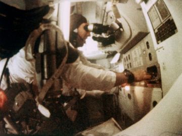
As a matter of interest: the Apollo Space Program used combinations of Radar and Astronavigation to fly to the Moon and back.
OMEGA
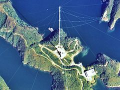
OMEGA was the first global-range radio navigation system, operated by the United States in cooperation with six partner nations. It was a hyperbolic navigation system, enabling ships and aircraft to determine their position by receiving very low frequency (VLF) radio signals in the range 10 to 14 kHz, transmitted by a global network of eight fixed terrestrial radio beacons, using a navigation receiver unit. It became operational around 1971 and was shut down in 1997 in favour of the Global Positioning System.
LORAN
LORAN, short for LOng RAnge Navigation, should actually be part of the Radio Navigation section. Like OMEGA it was a hyperbolic radio navigation system developed in the United States during World War II. It had a range up to 1,500 miles (2,400 km) with an accuracy of tens of miles. It was first used for ship convoys crossing the Atlantic Ocean, and then by long-range patrol aircraft, but found its main use on the ships and aircraft operating in the Pacific theater during World War II.
After the war Loran-C combined two different techniques to provide a signal that was both long-range and highly accurate, features that had formerly been incompatible. Accuracy improved from 400 to appx. 10 meters. The US Coast Guard was its main user and provider. In 2010 it became obsolete and since 2015 most countries have switched of their facilities.
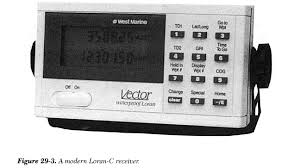
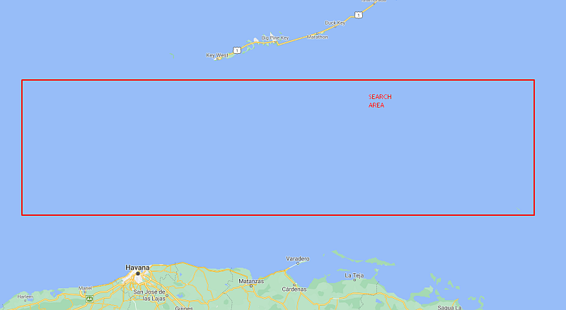
I used to have a Loran-C receiver, similar as above, installed in my aircraft. There was no GPS in those days (mid '90s). It was put to good use while I flew in Florida, during SAR flights over the waters between Cuba and Key West (FL).
| <- back | next -> | |
|---|---|---|